 Catalogue IFL
economy
Type of resources
Available actions
Topics
Keywords
Contact for the resource
Provided by
Formats
Representation types
Update frequencies
status
Scale
-

The ISO19115 metadata standard is the preferred metadata standard to use. This template is multilingual with a default language set to english. Other language could be used to translate part of the metadata record. Main language is define in metadata section. Other languages could be added to metadata section / locale element.
-
-
The OSM Points of Interest (POI) theme includes two complementary layers: - a layer (osm_fr_poi_hstore in French, osm_en_poi_hstore in English) containing all the point objects in the selected territory bearing the OSM keys amenity, craft, emergency, healthcare, healthcare:speciality, historic, leisure, man_made, military, office, power, pump, shop or tourism, translated into French as equipement, artisanat, urgences, sante_structure, sante_structure_type, historique, loisirs, structure_artificielle, militaire, bureau, energie, pompe, commerce et tourisme - a layer (osm_fr_poi_plg_hstore in French, osm_en_poi_plg_hstore in English) containing all the polygonal objects of the selected territory with the same OSM keys as the previous layer These two layers display in their attribute table the most important name fields, those of the addressing and then, classified in alphabetical order, fields corresponding to the most commonly used OSM keys for this theme, as well as an hstore field containing all the OSM tags of the object. They are produced daily by LLg via imposm from the raw data proposed by Geofabrik. Consult the parent sheet for more information, access to data on available areas or to other themes. Translated with www.DeepL.com/Translator (free version)
-
Country-wide download point and map for partial extraction of OSM thematic layers, available in the original English version or translated into French (for example, amenity=college and craft=joiner become equipement=enseignement supérieur et artisanat=menuisier), and updated daily via imposm from raw data supplied by Geofabrik. There are two ways to download the data: - either the entire territory in one of the formats available via the WFS point "OSM EN and FR thematic layers for the whole country" below - or on a part of the territory to be drawn by yourself or to be chosen within the administrative boundaries of the country in question, by clicking on the link "Display map and full or partial extraction in EN or FR" to access from a MapStore context over the country. Demonstration videos are available here: https://llg-collabora.ethibox.fr/s/owY8DQTQpgDr8sw Currently, GEOPACKAGE FORMAT IS NOT FUNCTIONAL (the resulting layers are empty): prefer geojson format to retrieve all field names and convert them to geopackage from QGIS. For further information on this LLg download point, please consult the parent metadata sheet linked at the bottom of this page, which also leads to child sheets presenting each theme offered.
-
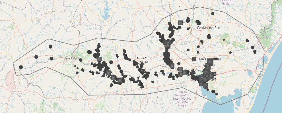
Download point, for the area of Rio Grande do Sul affected by the May 2024 floods, for 16 OSM thematic layers updated daily via imposm from raw data supplied by Geofabrik. To download the data, see the WFS item "OSM thematic layers for the whole state". Currently, GEOPACKAGE FORMAT IS NOT FUNCTIONAL (the resulting layers are empty): prefer geojson format to retrieve all field names and convert them to geopackage from QGIS.
-
Country-wide download point and map for partial extraction of OSM thematic layers, available in the original English version or translated into French (for example, amenity=college and craft=joiner become equipement=enseignement supérieur et artisanat=menuisier), and updated daily via imposm from raw data supplied by Geofabrik. There are two ways to download the data: - either the entire territory in one of the formats available via the WFS point "OSM EN and FR thematic layers for the whole country" below - or on a part of the territory to be drawn by yourself or to be chosen within the administrative boundaries of the country in question, by clicking on the link "Display map and full or partial extraction in EN or FR" to access from a MapStore context over the country. Demonstration videos are available here: https://llg-collabora.ethibox.fr/s/owY8DQTQpgDr8sw Currently, GEOPACKAGE FORMAT IS NOT FUNCTIONAL (the resulting layers are empty): prefer geojson format to retrieve all field names and convert them to geopackage from QGIS. For further information on this LLg download point, please consult the parent metadata sheet linked at the bottom of this page, which also leads to child sheets presenting each theme offered.
-
Download point for the Lyons metropolitan area and partial extraction map for OSM thematic layers, available in the original English or translated into French (for example, amenity=college and craft=joiner become equipement=higher education and artisanat=carpenter), and updated daily via imposm from raw data supplied by Geofabrik. There are two ways to download the data: - either the entire territory in one of the formats available via the WFS point "OSM EN and FR thematic layers on the entire territory" below - or on a part of the territory to draw yourself or to choose within the administrative boundaries of the territory in question, by clicking on the link "Extraction by zones or admin boundaries - EN and FR thematic layers" to access from a MapStore context on the territory. Demonstration videos are available here: https://llg-collabora.ethibox.fr/s/owY8DQTQpgDr8sw Currently, GEOPACKAGE FORMAT IS NOT FUNCTIONAL (the resulting layers are empty): prefer geojson format to retrieve all field names and convert them to geopackage from QGIS. For further information on this LLg download point, please consult the parent metadata sheet linked at the bottom of this page, which also leads to child sheets presenting each theme offered.
-

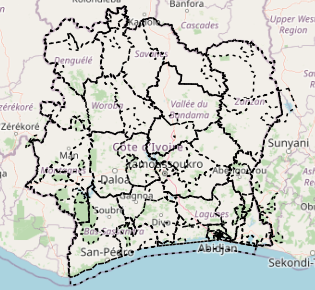
Country-wide download point and map for partial extraction of OSM thematic layers, available in the original English version or translated into French (for example, amenity=college and craft=joiner become equipement=enseignement supérieur et artisanat=menuisier), and updated daily via imposm from raw data supplied by Geofabrik. There are two ways to download the data: - either the entire territory in one of the formats available via the WFS point "OSM EN and FR thematic layers for the whole country" below - or on a part of the territory to be drawn by yourself or to be chosen within the administrative boundaries of the country in question, by clicking on the link "Display map and full or partial extraction in EN or FR" to access from a MapStore context over the country. Demonstration videos are available here: https://llg-collabora.ethibox.fr/s/owY8DQTQpgDr8sw Currently, GEOPACKAGE FORMAT IS NOT FUNCTIONAL (the resulting layers are empty): prefer geojson format to retrieve all field names and convert them to geopackage from QGIS. For further information on this LLg download point, please consult the parent metadata sheet linked at the bottom of this page, which also leads to child sheets presenting each theme offered.
-
Country-wide download point and map for partial extraction of OSM thematic layers, available in the original English version or translated into French (for example, amenity=college and craft=joiner become equipement=enseignement supérieur et artisanat=menuisier), and updated daily via imposm from raw data supplied by Geofabrik. There are two ways to download the data: - either the entire territory in one of the formats available via the WFS point "OSM EN and FR thematic layers for the whole country" below - or on a part of the territory to be drawn by yourself or to be chosen within the administrative boundaries of the country in question, by clicking on the link "Display map and full or partial extraction of EN and FR layers" to access from a MapStore context over the country. Demonstration videos are available here: https://llg-collabora.ethibox.fr/s/owY8DQTQpgDr8sw Currently, GEOPACKAGE FORMAT IS NOT FUNCTIONAL (the resulting layers are empty): prefer geojson format to retrieve all field names and convert them to geopackage from QGIS. For further information on this LLg download point, please consult the parent metadata sheet linked at the bottom of this page, which also leads to child sheets presenting each theme offered.
-
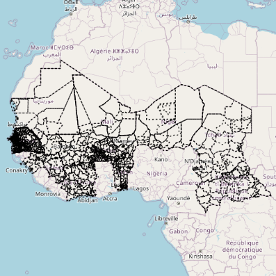
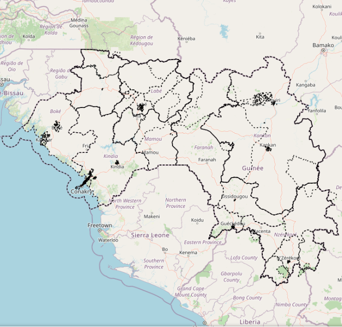
LLg makes available in the IFL OpenStreetMap thematic datasets for French-speaking West African countries, available either with their original attributes ("tags"), mostly in English, or in a version where over 1400 categorized attributes are translated into French, from existing translations in the OSM wiki and JOSM editor. The list of translated tags can be found here: https://gitlab.com/leslibresgeographes/osm-tags-translation/-/blob/main/LLG_OSM_SQL_translation_EN_FR_GitLab.tsv These two datasets each represent 16 layers covering 8 different themes, as well as a "Planet" theme grouping all OSM objects on the territory in order to recreate its own themes. Each theme is presented in the list of related resources below. The attribute table for each theme presents both the most common OSM keys and an hstore field containing all the attributes of each object. --------------------------------------------------- These OpenStreetMap datasets are updated daily via imposm from the raw .obf data supplied by Geofabrik, and then translated. Until these updates are complete, the old layers remain available. --------------------------------------------------- To access the data, scroll down to "Sources datasets" and open the country file to download the desired theme(s): - either directly from the country sheet, the entire territory in one of the available formats - or from a MapStore context, on a part of the territory to be drawn by yourself or chosen within the administrative boundaries of the country in question. Demonstration videos are available here: https://llg-collabora.ethibox.fr/s/owY8DQTQpgDr8sw